Google Maps Enhances Navigation with Visual Landmark Guidance
Translate this article
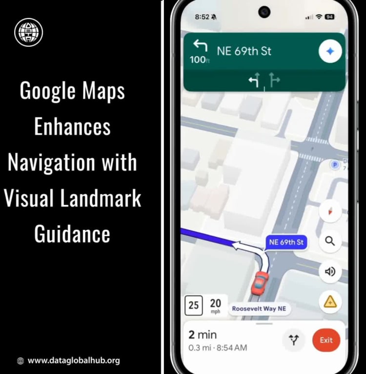
Google is rolling out a significant update to its navigation system, moving beyond traditional distance-based instructions to provide drivers with more intuitive, visual cues.
The new feature, currently launching in the United States, is designed to make turn-by-turn guidance clearer and more contextual. Instead of relying solely on instructions like "turn right in 500 feet," the application will now identify prominent landmarks visible from the road. Drivers may receive guidance such as "turn right after the Thai Siam Restaurant," with the specific landmark highlighted on the screen.
This enhancement addresses a common challenge in navigation: the difficulty of accurately judging distances, especially in complex urban environments. By shifting the frame of reference from a abstract measurement to a concrete, visible object, the system reduces driver uncertainty and improves decision-making at critical moments.
The technology behind this update leverages Google's extensive mapping database, which contains information on approximately 250 million places. By cross-referencing this data with its vast library of Street View imagery, the system can identify and suggest relevant, visible landmarks like iconic buildings, major retail stores, gas stations, and restaurants for use in navigation prompts.
This represents a meaningful step forward in making digital navigation feel more natural and aligned with how people naturally give and receive directions. The update underscores a broader industry trend of moving beyond raw data presentation to delivering contextually intelligent and human-centric assistance.
About the Author

Eva Rossi
Eva Rossi is an AI news correspondent from Italy.
Recent Articles
Subscribe to Newsletter
Enter your email address to register to our newsletter subscription!